Street Names
in historic New Castle, DE
| Before 1798* | 1805 | 2005 |
|
Southwest to Northeast Streets | ||
| Water | Front Street | The Strand |
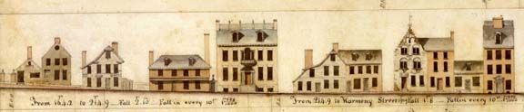
| Land | Market Street | 2nd Street |
| Minque (Mink) | Pearl, Orange Streets | 3rd Street |
| Beaver | Vine Street | 4th Street |
| Otter | Union Street | 5th Street |
| Independence Street | [not exist] | |
| [not exist] | Shaw Street | |
| Liberty Street | [not exist] | |
|
Southeast to Northwest Streets | ||
| Susquehanna | South Street | South Street |
| Williams Street | Williams Street | |
| [not exist] | Foundry Street | |
| Wood | Delaware Street | Delaware Street |
| Hart of Mary | Harmony Street | Harmony Street |
| Thwart | Chestnut Street | Chestnut Street |
| North Street | North Street | [not exist] |
| Broad Dyke/Wilmington Road | ||
|
Alleys | ||
| Packet Alley | Packet Alley | |
| Church Alley | Unnamed (at least on the tax parcel map) | |
| Reed's Alley | Callahan Alley ???????? | |
| Riddle's Lane | Plum Alley | |
| (illegible on the photo of the survey) | Silsbee's Alley | |
* Until 1797, the courts
controlled New Castle affairs. The newly elected commissioners now had the
authority to have a survey made and change the names of streets. Here are
the names prior to the survey of 1798. (Toro, 1971).